Principal Investigators: Courtney Conway & Kristen Dillon
Overview:
With funding from the Arizona Game and Fish Department Heritage Fund, we are combining lidar (Light Detection and Ranging) data and avian point-count data to create a series of predictive models of the distribution and abundance of red-faced warblers in Arizona. Lidar is remote sensing technology that provides very accurate information at small spatial scales on vegetation height, canopy cover, and other vegetation features.
Habitat structure influences breeding distribution, reproductive success, and survival of most animals (Dunlavey 1935, MacArthur and MacArthur 1961). Understanding species-habitat associations is essential for ecologists to develop effective conservation and management strategies. Quantifying habitat structure based on field-based vegetation surveys over a large geographic area is not logistically feasible, especially for species that occupy remote areas. Developing habitat-association models based on remote sensing data that does not require field-based measurements may allow managers to accurately map species’ distributions and make demographic predictions over broad geographic areas. Developing a predictive habitat model for red-faced warblers would greatly benefit land managers and conservation organizations because this iconic species of the southwestern U.S. breeds in disjunct and remote mountainous areas in the region.
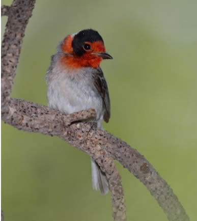
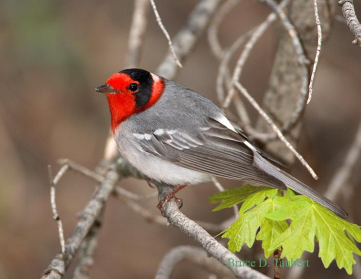
Why Red-faced Warblers?
The red-faced warbler is listed as an Arizona Partners-in-Flight species of concern. The species has a highly restricted breeding range, limited in the United States to high-elevation riparian coniferous woodlands in Arizona and southwestern New Mexico. Habitat loss and degradation is thought to be the main threat to this species. However, detailed projections of the breeding distribution and estimates of relative abundance of red-faced warblers are currently not available. In fact, the Arizona Partners-in-Flight conservation plan is listed within the “Bird” element of Arizona Game and Fish Department Heritage Program’s IIAPM Funding Window and identifies determining the distribution of current red-faced warbler populations as the top research priority for the species.
This project is designed to address the number one research recommendation by Partners-in-Flight for red-faced warblers: determining the distribution of current red-faced warbler populations. This project will also establish baseline data for monitoring red-faced warbler habitat trends. The current breeding distribution maps for red-faced warblers are vague and were not based on fine-scaled survey data or validated predictive models, making habitat protection difficult for a species thought to be threatened by habitat loss and human disturbance. This problem has a statewide scope, and our research will attempt to address it on both the local and statewide scale.
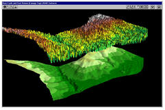
Why Lidar?
Lidar is a relatively new source of remote sensing data that uses a laser to directly measure the three-dimensional distribution of plant canopy and subcanopy topography. Lidar allows highly accurate estimates of vegetation height, canopy cover, and canopy structure. The result is three-dimensional measurements of vegetation structure over large areas, including data from locations that are difficult or impossible to reach on foot. Wildlife biologists are only just beginning to utilize this new form of remote sensing in research and management, but it has the potential to offer a powerful new approach to habitat modeling which would allow much more accurate methods for mapping species distributions. Find out more about lidar here.


Source: https://www.e-education.psu.edu/lidar/l8_p5.html